|
|
|
|
|
|
| Dennis Ancinec | profile | all galleries >> Communities of San Diego County >> The Desert | tree view | thumbnails | slideshow |
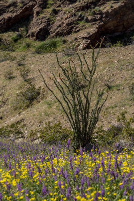
The North American deserts, which occupy approximately one-half million square miles of the southwestern United States and northern Mexico, represent the fifth largest of the world's desert regions. The southern California desert is divided by the San Gabriel and San Bernardino Mountains (of the Transverse Range) into the Mojave Desert to the north and the Colorado Desert to the south. The Mojave is a high desert with elevations averaging more than 2,000 feet and summer daytime temperatures in the 90's, while the Colorado Desert elevations drop to below sea level and exhibits summer daytime temperatures of over 100 degrees F. |
| ||
Deserts occur in the middle latitudes where descending dry air currents frequently contact the earth and prevent the passage of rain-laden air. High mountains such as the Peninsular Ranges act as barriers to the movement of moist air from the Pacific Ocean, thus contributing to the dryness. Another drying factor is the low rate of evaporation from the cold California current. This results in the formation of cool dry air masses that move inland.* *Extracted Natural History of Southern California: Ancinec, Radford, Schwenkmeyer | |||
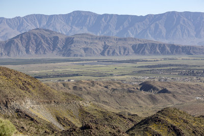 View of Borrego Springs |
gallery: Desert Perennials |
gallery: Desert Annuals |
| comment | share |
| blizzard | 24-Jan-2008 21:05 | |