07-MAY-2005
Still in Use
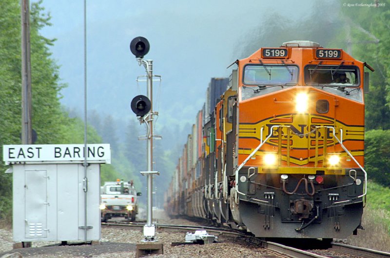
On the way up I stopped at East Baring to watch this eastbound stack train cruise up the grade at track speed. This part of the line is obviously still in use by Great Northern’s successor, Burlington Northern Santa Fe (BNSF). To the left is a track inspector in the full size Ford hi-rail.
07-MAY-2005
An Overview of the Site
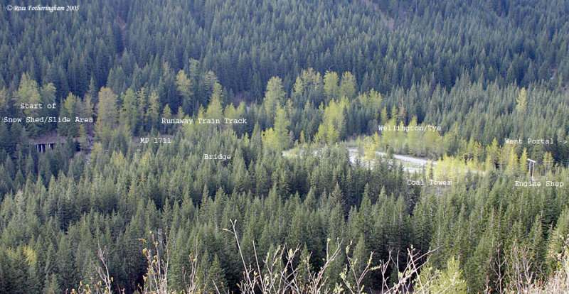
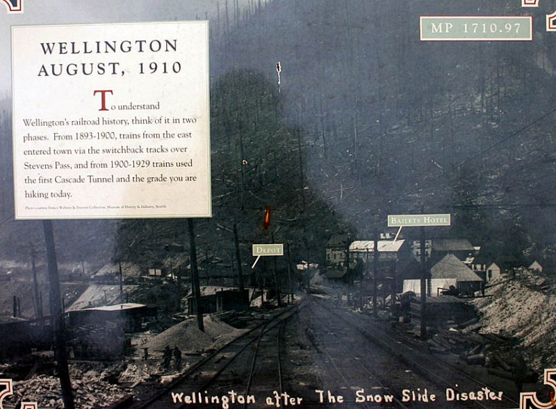
Next stop was the former town of Wellington. The town sits in the valley below highway 2, and at the mouth of the Old Cascade tunnel. After the avalanche, the railroad renames the town Tye, but it is still called Wellington to this day. The town was home almost solely to railroad employees.
About 15 years ago, you could easily see the concrete snow shed from highway 2, now there is only a few spots that are still visible.
07-MAY-2005
Back Then
An overview of Wellington from the past looking northwest. The area where this picture was taken is overgrown, and cannot be duplicated today.
07-MAY-2005
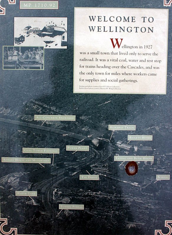
Before the Slide
One of the signs showing the town of Wellington before the slide.
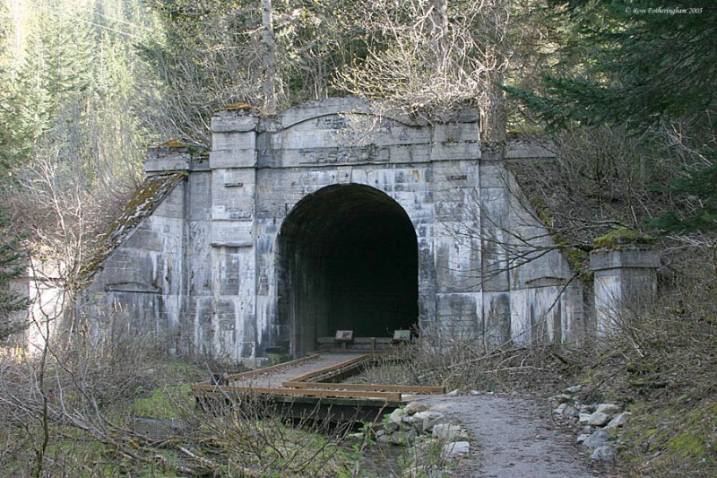
The Old West Portal
First stop in Wellington was the west portal of the old 2.6 mile long Cascade Tunnel. This part of the line was abandoned in 1929, when the Great Northern had a longer tunnel built at a lower elevation.
07-MAY-2005
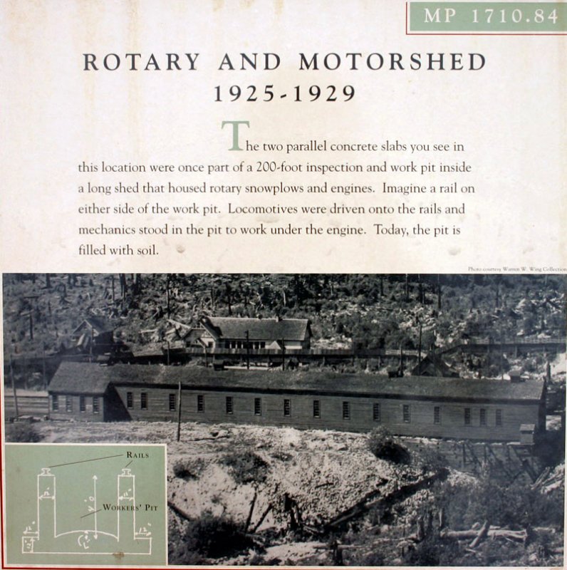
Remains of the Engine House
The concrete foundation are the only remains. In this picture you can see the outline of the work pit. Engines would drive over the pit, giving the mechanics easy access to the underside.
07-MAY-2005
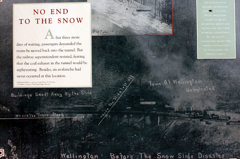
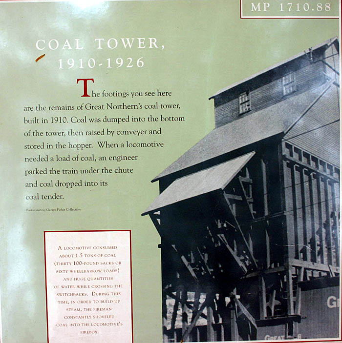
Coal Tower Then
From 1910, to 1926, a coal tower supplied locomotives, and rotary plows with coal if they were running low. Steam was the power of choice during this period, so coal was in big demand. I don’t know if this project was a direct result of the avalanche, but one of the problems was that the snowplows were out of coal, making them useless. The tower was constructed after the avalanche.
07-MAY-2005
Milepost 1711 Now
Looking west towards MP 1711. The grade for the runaway train track is on the right.
07-MAY-2005
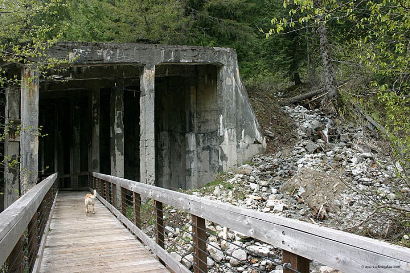
Concrete Snow Shed
The entrance of the concrete snow shed with my trusty trail-blazing dog leading the way. I believe this is Haskell creek on the left. This was the only all-concrete snow shed that the Great Northern ever built. Its nearly a ˝ mile long, and marks the approximate eastern extent of the 1910 avalanche. Just to clarify, the snow shed was built after the avalanche.
07-MAY-2005
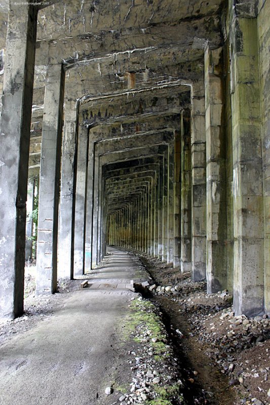
Inside the Shed
A view down what was the right of way. There were 2 tracks sheltered under the snow shed.
07-MAY-2005
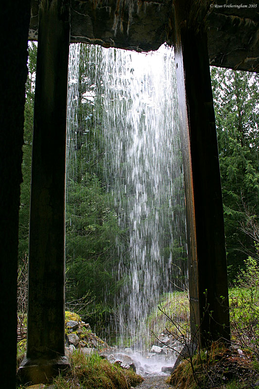
Still Protecting the Line
One of the many streams that the snow shed still shelters the route from, 95 years later.
07-MAY-2005
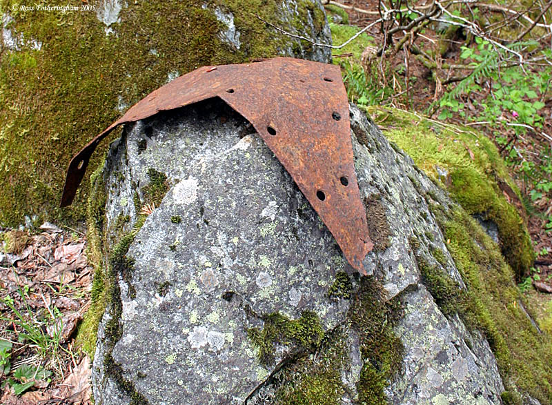
Start of the Debris Field
I decided to head down into the valley below to start searching for evidence of the 1910 tragedy. It wasn’t hard to find the debris field. One of the first pieces I found was some sort of mounting flange bent around a rock.
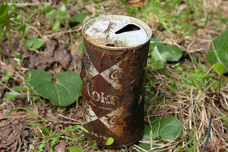
07-MAY-2005
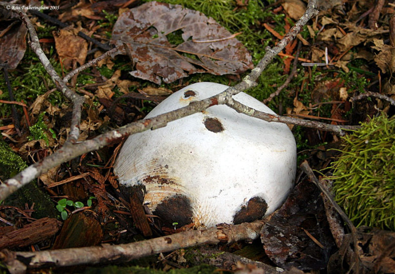
Old Coke Can
A tin Coke can. I briefly looked online to try and date it, but the results are still out. I do not believe this to be a part of the tragedy
07-MAY-2005
Large Tank
One of the larger pieces, it’s about the size of a household water heater.
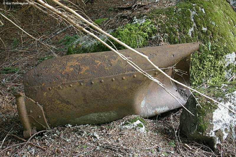
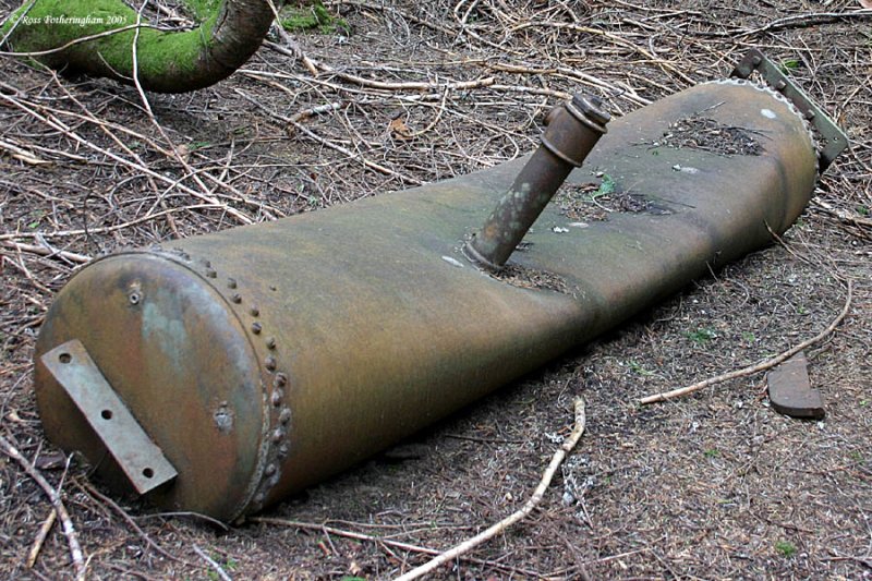
07-MAY-2005
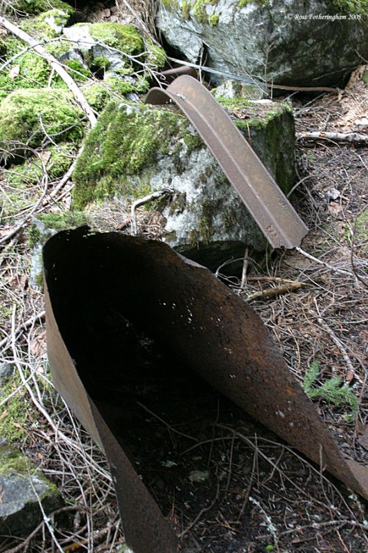
Another Large Tank
This one was all the way down the valley next to the Tye River. It’s about 24 inches in diameter, and 6 or more feet long. From the amount of studs around the access hole, it looks like it may have held steam at pressure.
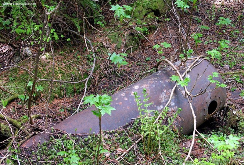
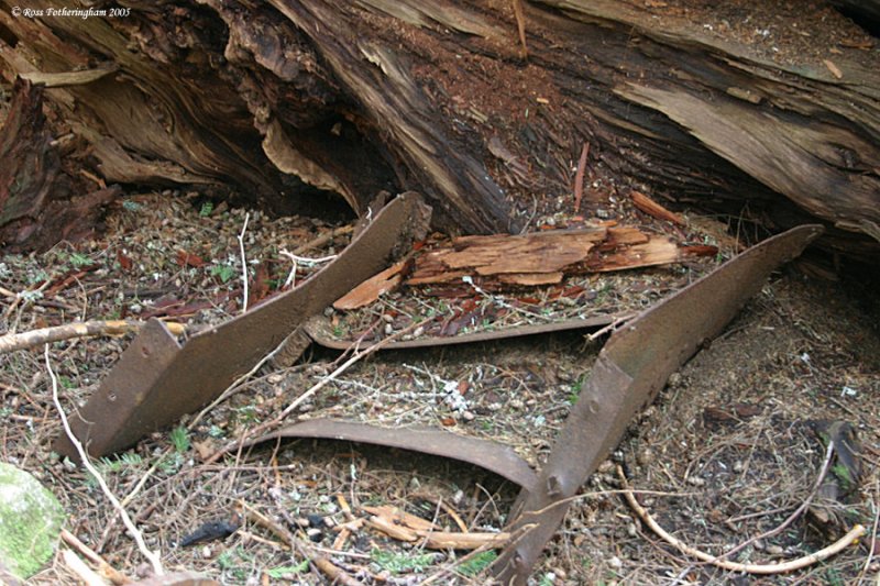
07-MAY-2005
Brakemen's Step
A brakeman’s step (U-shaped) among other debris.
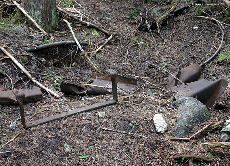
07-MAY-2005
Passenger Stairs
I believe these are steps from a passenger coach. These too were all the way down at the bank of the Tye River.
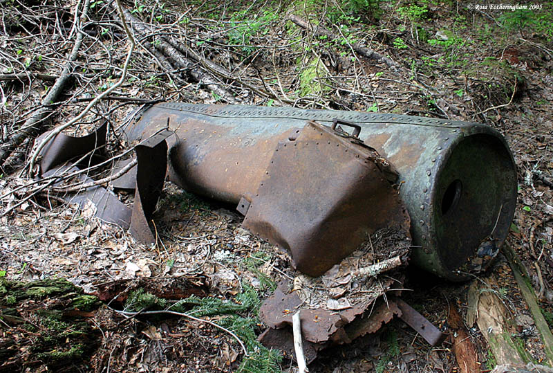
07-MAY-2005
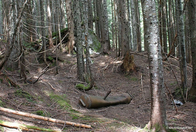
Large Steam Tank
This is one of the largest pieces of debris. It’s about 30 inches in diameter, and 8 to 9 feet long. It looks to be the site of where 2 engines came to rest.
07-MAY-2005
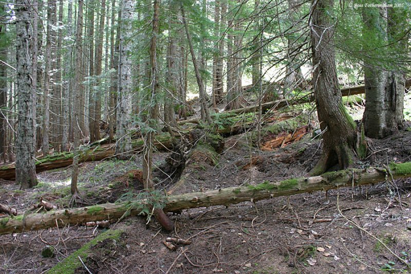
Downed Trees
In this shot I am standing on a huge tree trunk looking along the slope. You can see other downed trees that look to be from the 1910 avalanche.
07-MAY-2005
More Debris
Yet another tank, and what looks to be more steps to the left of the tank.
07-MAY-2005
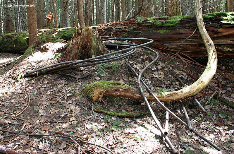
Steam Pipes Wrapped Around a Tree Trunk
Next is another image showing the raw power of the avalanche. I believe that the picture below is at the same spot as the picture in the link.
http://home1.gte.net/mvmmvm/picts/lg/stump.jpg
07-MAY-2005
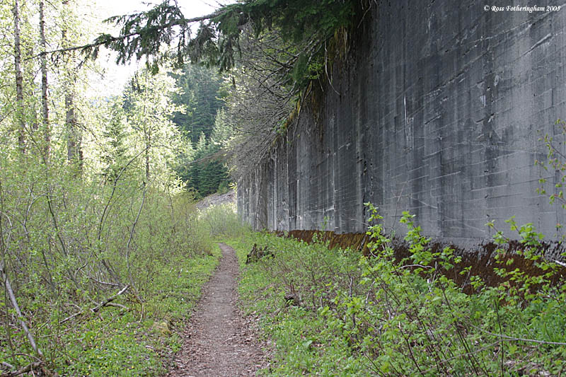
Back on the Old Right of Way
Snow shed continue for the next few miles down the mountain. Seen as a costly solution, the Great Northern made less expensive sheds out of 12 by 12 inch timbers which were reinforced by a concrete wall seen in the picture below. When the line was abandoned in 1929, the timbers were salvaged, but the concrete walls can still be seen today.
This combination snow shed was built in 1911, and extended in 1916 to a total length of 778 feet. By 1918, the railway had covered almost the entire length between Windy Ridge, and the west portal with snow sheds.
07-MAY-2005
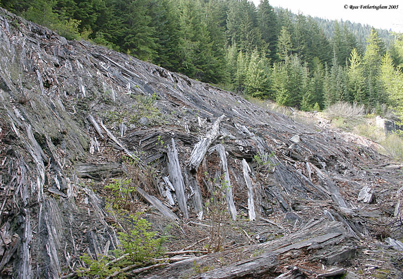
Wooden Snowsheds
See here are the remains of an all-timber snow shed. Built in 1910, and was 256 feet long. The timbers in this section were too rotten to salvage, so the railroad left this section intact.
07-MAY-2005
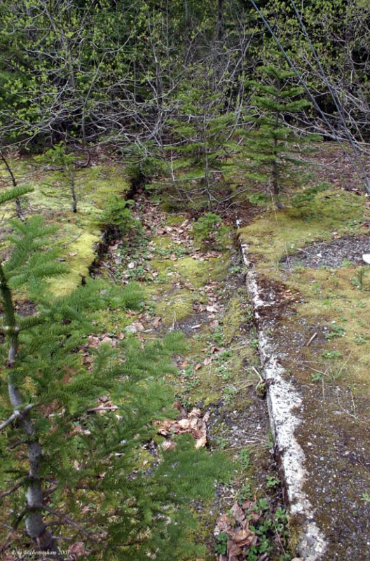
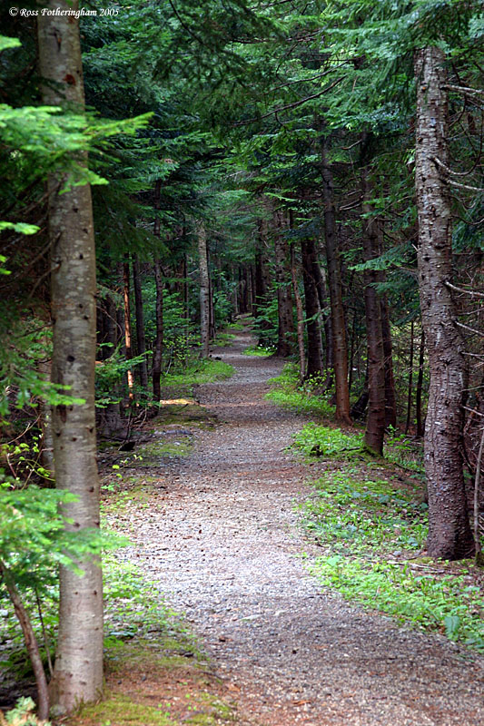
Nature Reclaiming Again
We went as far as milepost 1713, and then turned around.
Here we got a view up the right-of-way showing how the forest is slowly reclaiming the line.
07-MAY-2005
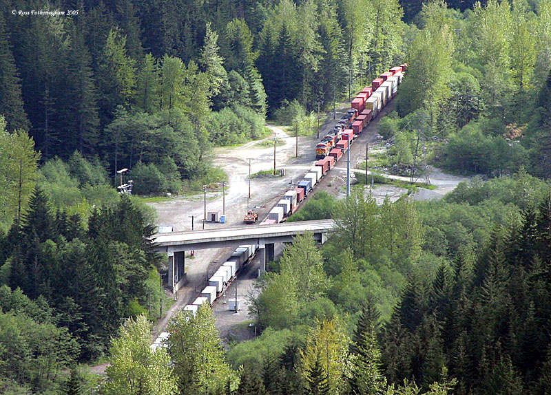
Birds Eye View
A birds eye view of Scenic, where the relocated Great Northern line is still active (Now BNSF). A westbound Z train (which is the modern day equivalent in priority to the mail train stuck at Wellington) has just come out of the 7.8-mile long tunnel, and is passing under Highway 2, while an eastbound waits in the siding.
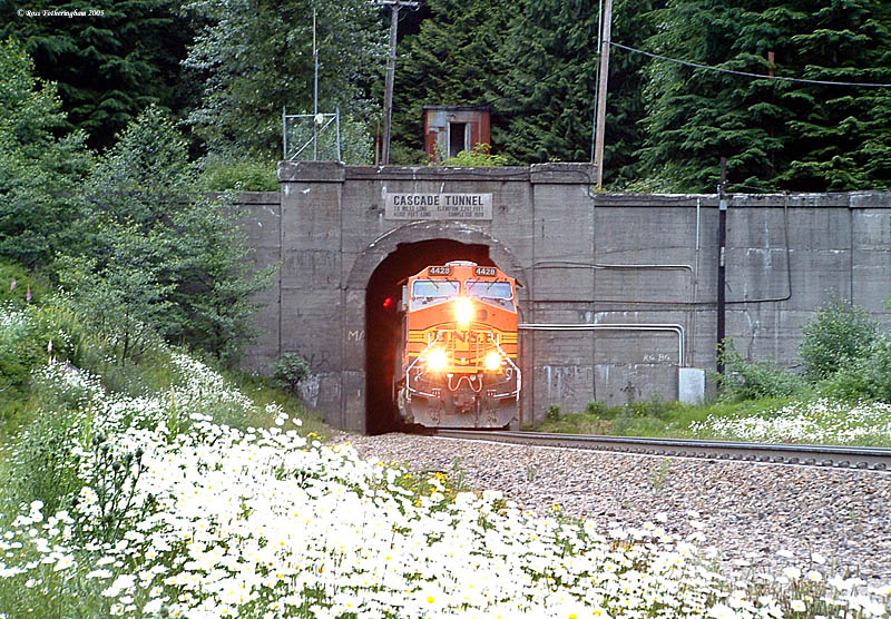
Solution; A 7.8 Mile Long Tunnel
A view from the ground as a westbound exists the tunnel that put the upper line out of business. Special Thanks to Martin Burwash who gave me a lot of help, direction, and answered a lot of my questions.